Beginner terrain
that is good as you develop your backcountry skills and when the avalanche danger is higher. Click for details.
Intermediate
terrain that requires more experience in skinning and skiing. Click for details.
Advanced terrain
that requires strong skiing and skinning skills. Click for details.
Expert terrain that is
challenging and a small mistake can have serious consequences. Click for details.
Extreme terrain
that includes insanely difficult chute skiing and beyond. Click for details.
The difficulty of this terrain
varies widely. Click for details.
This terrain hasn't
been rated. Click for details.
Although this slope was measured, slopes are not homogeneous—this should be considered approximate. Click for details.
This slope angle was not measured. If you get an accurate slope measurement, please send it to me at info@vRigger.com.
The slope angle varies widely. Click for details.
This is the general direction the slope faces. Click for details.
The Utah Avalanche Center says that dangerous avalanches are not expected in this terrain except during extreme or very unusual conditions. Click for details.
The Utah Avalanche Center says that this is generally low-angle terrain although the route may cross under steep avalanche runout zones. Click for details.
The Utah Avalanche Center says that this terrain has significant exposure to numerous commonly-occurring avalanche paths. Click for details.
The Utah Avalanche Center says that this terrain is exposed to significant avalanche hazards often with multiple terrain traps. Click for details.
This terrain can be accessed by resort skiers without skins. Click for details.
This terrain can be accessed by resort skiers without skins. Snowmobiles are allowed. Click for details.
This terrain is commonly skied by helicopter skiers. Click for details.
This terrain is commonly skied by helicopter skiers and by resort skiers without skins. Click for details.
This terrain is commonly skied by helicopter skiers, by resort skiers without skins, and by snowmobilers. Click for details.
This terrain is commonly skied by helicopter skiers. Snowmobiles are allowed. Click for details.
Snowmobiles are allowed in this terrain. Click for details.
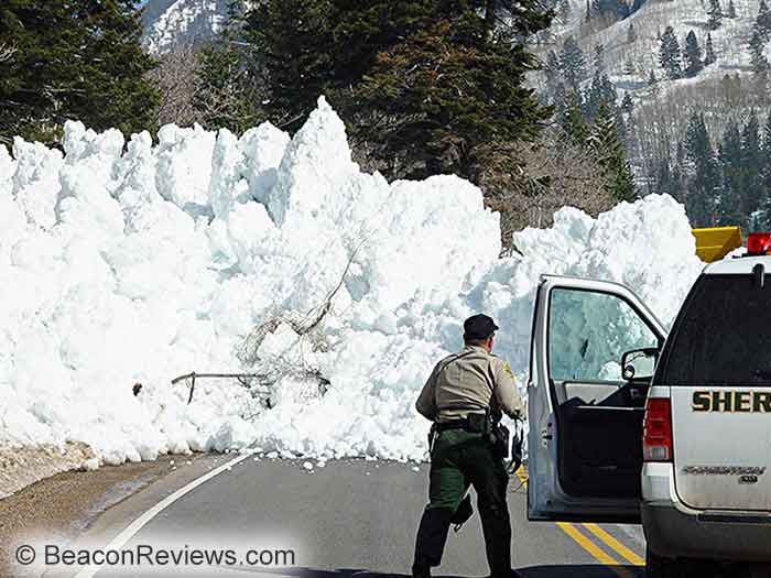
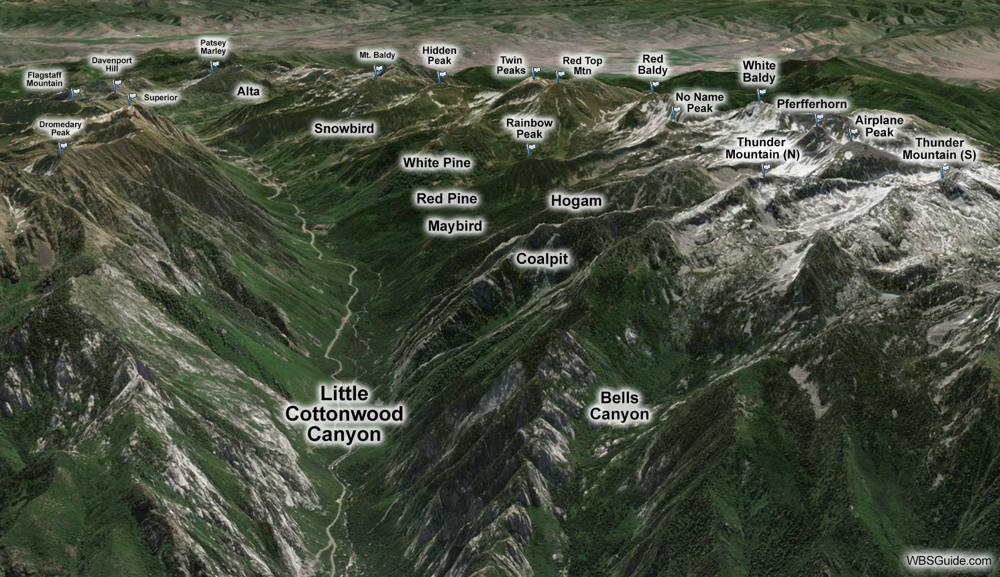
Classic. Steep. Popular. Little Cottonwood Canyon is all that, and more. Simply driving up highway
210 feels like a backcountry experience. And with 35 avalanche paths crossing the road, highway 210 is the
most avalanche-prone highway in the nation.
The skiing ranges from short beginner runs to badass steeps that descend more than 5,000 vertical
feet.
Although there is plenty of backcountry skiing down-canyon, the majority of the backcountry skiing in Little
Cottonwood Canyon is accessed from the White Pine, Central Alta,
and Grizzly Gulch trailheads.
Getting to Little Cottonwood Canyon
Take the 6200 South exit from the I-215 belt route and head east (toward the mountains). Drive 6.6
miles and the road will enter Little Cottonwood Canyon.
North Side of Little Cottonwood
The drainages on the north side of Little Cottonwood canyon are steep and tower over the road. Most
of these are chute-like runs that are booted (rather than skinned) in the spring. Never
ski these slopes when there is any possibility of an avalanche occurring and reaching the road—you don't
want to be the one that takes out a bus full of children.