


| Days Fork | |
|---|---|
| Trailheads |
Spruces Trailhead Central Alta Trailhead |
| Location | 40.6155° / -111.6345° |
| Online Map | View on wbskiing.com |
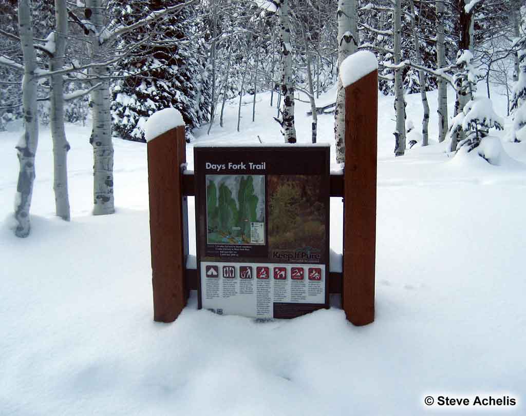
Days Fork is located on the south side of Big Cottonwood Canyon behind the Spruces parking lot. Silver Fork is up-canyon from Days Fork and Greens Basin is nestled at the base of the ridge that separates Silver Fork from Days Fork. Cardiff Fork is down-canyon from Days Fork. The ridge between Days Fork and Cardiff Fork is named Reed & Benson.
Days Fork offers outstanding intermediate and advanced skiing. The quality of the terrain, the snow, and the ease of access from Alta (and helicopters) make upper Days Fork a very popular place.

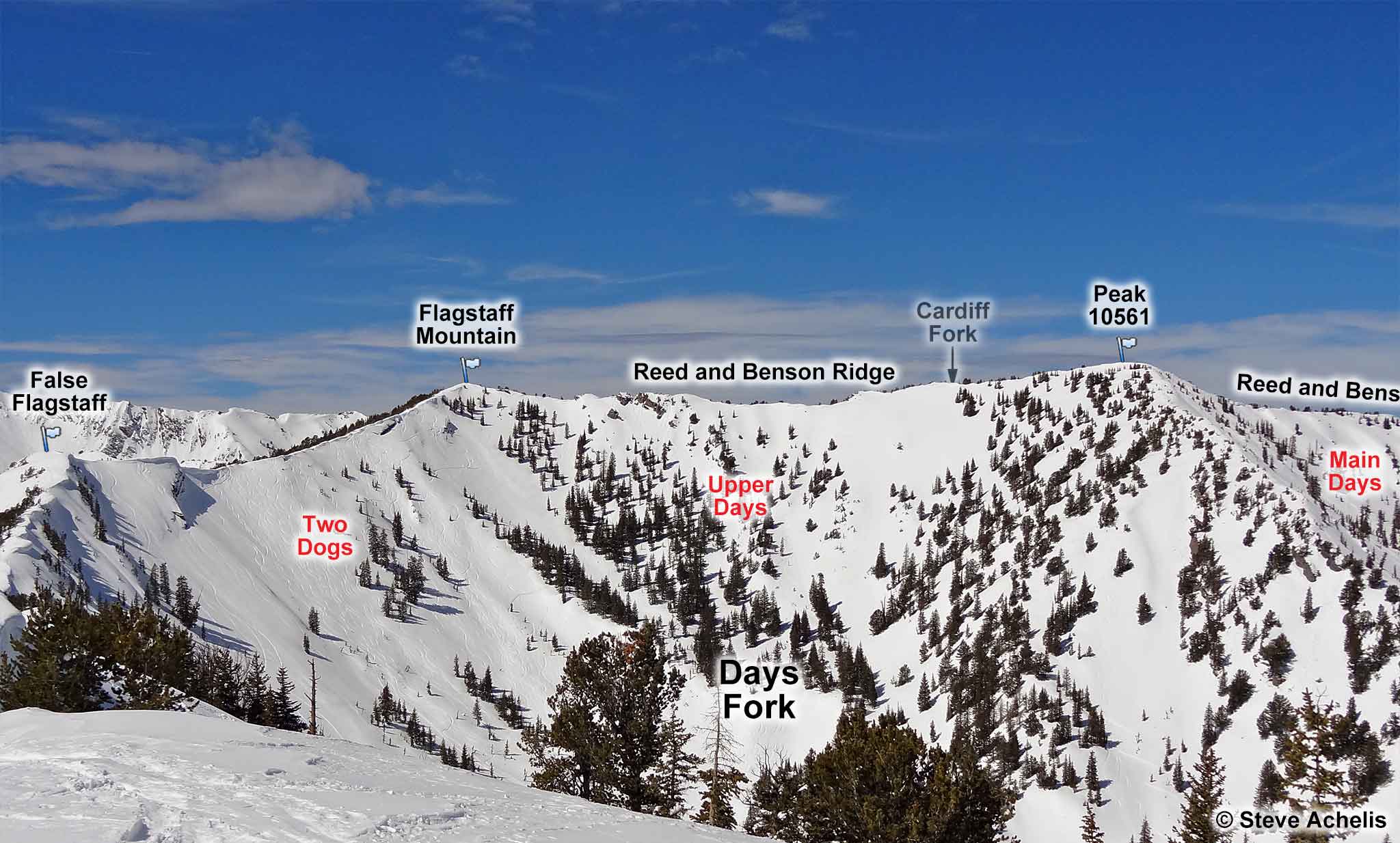
Days Fork can be reached from either Big or Little Cottonwood. The runs in upper Days Fork (e.g., Hideaway Park, Jaws, Oingo Boingo, Two Dogs, and Upper Days) are much easier to access from Little Cottonwood Canyon. The runs in lower Days Fork (e.g., Days Draw, Banana Belt, and Main Days) are easier to access from Big Cottonwood Canyon.
| Days Fork from the Spruces Trailhead | |
|---|---|
| Trailhead | Spruces Trailhead |
| Trailhead Elevation | 7,350' |
| Ridge Elevation | 10,200' |
| Total Vertical | 2,800' |
| Skinning Distance | 3.2 miles |
| Online Map | View on wbskiing.com |
Drive 9.5 miles up Big Cottonwood Canyon and park at the Spruces parking lot. Skin up the Days Fork trail which begins in the southwest (far-right) corner of the parking lot. The trail passes right of bathrooms (real flush toilets that are open in the winter) and a small baseball field, and enters the Days Fork drainage.
The main skin track goes up the center of the Days Fork drainage. Note that a few hundred feet after crossing the meadow at the base of Days Draw there is a significant terrain trap gully that frequently avalanches. There is often a skin track that goes to the right (west) to avoid the gully.
| Days Fork from the Central Alta Trailhead | |
|---|---|
| Trailhead | Central Alta Trailhead |
| Trailhead Elevation | 8,670' |
| Ridge Elevation | 10,200' |
| Total Vertical | 1,500' |
| Skinning Distance | 0.8 miles |
| Online Map | View on wbskiing.com |
The runs in upper Days Fork are much easier to access from Little Cottonwood Canyon (i.e., it is 1,500 vertical feet to the ridgeline from Little Cottonwood versus 2,800 feet from Big Cottonwood).
Flagstaff Mountain is at the junction of the Reed and Benson Ridge and the Big Cottonwood Canyon/Little Cottonwood Canyon ridge. If you follow the route to False Flagstaff from the Central Alta trailhead, you'll arrive at the top Two Dogs.
You can also ascend the small ridge between Emma #1 and Emma #2 to go to the top of Binx's Ridge from the Bay City Tunnel trailhead. This will put you near the top of Jaws.


