


| Red Pine Fork | |
|---|---|
| Location | 40.5570° / -111.6987° |
| Online Map | View on wbskiing.com |
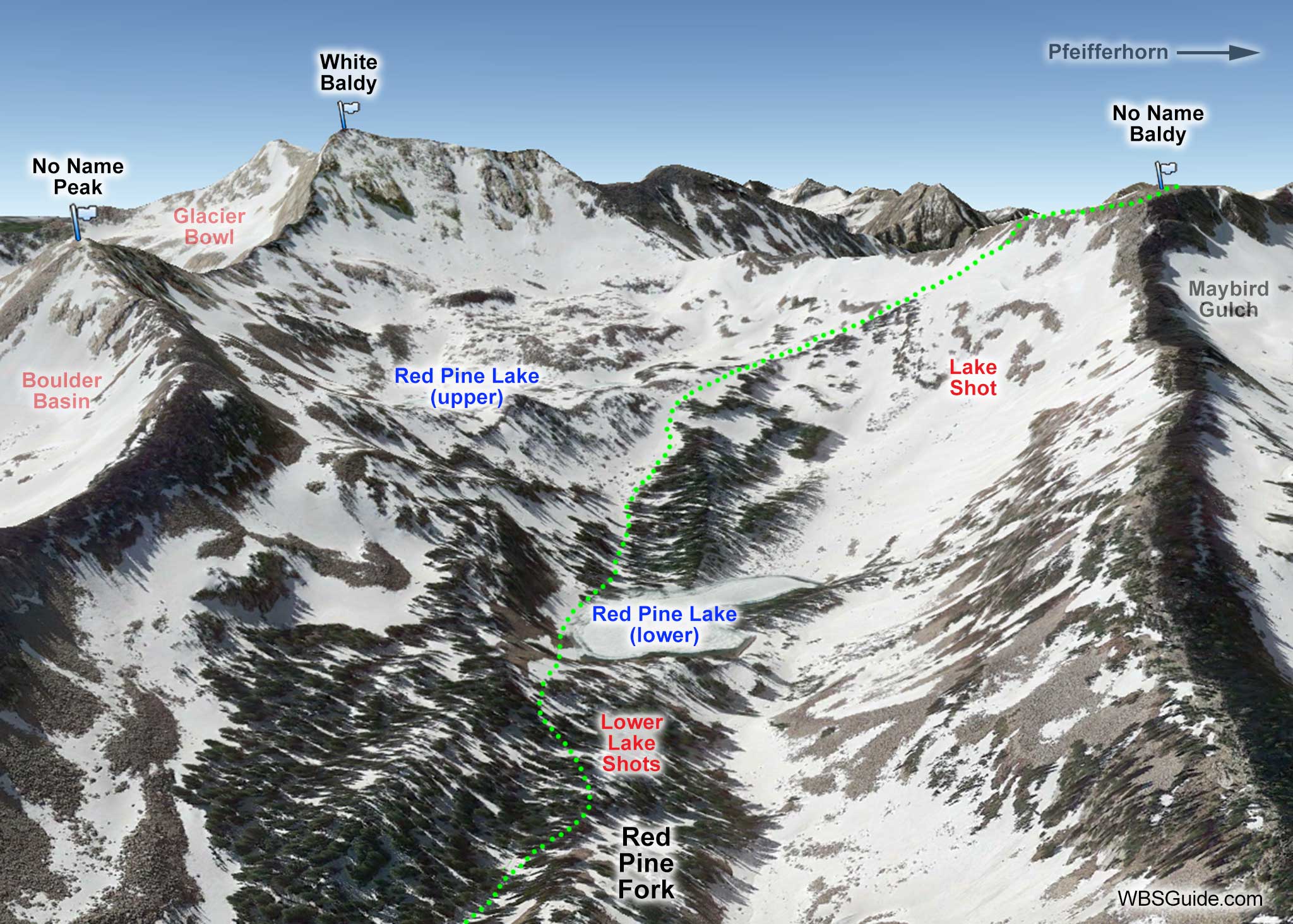
Red Pine Fork is on the south side of Little Cottonwood Canyon. It is west of White Pine Fork and east of Maybird Gulch. It is easily accessed from the White Pine trailhead. The upper end of the canyon is capped by White Baldy on the east and No Name Baldy on the west. There are two lakes, lower and upper Red Pine Lake. The normal ascent to the Pfeifferhorn (and its Northwest Couloir) is via Red Pine Fork.
Park at the White Pine trailhead. The trail starts in the southwest corner of the parking lot (near the bathrooms), goes downhill and to your left very briefly, and crosses the Little Cottonwood Canyon creek on a small footbridge. After less than 30 minutes of gentle climbing on an abandoned road, the trail meets the White Pine Fork creek. The road makes a hard left hand turn at this point and continues up White Pine Fork. A smaller trail branches to the right at this turn, crosses the creek, and contours west toward Red Pine Fork. Take this trail toward Red Pine Fork.
After less than 10 more minutes, you may see a skin track, or two, that departs to your left and heads up Pink Pine Ridge. Stay on the main westward-bound trail toward Red Pine Fork as it wraps around the "toe" of Pink Pine Ridge. If the weather is clear, you'll have a great view down Little Cottonwood Canyon into the Salt Lake valley. More likely, you'll have a view of the smog-filled valley—if so, be happy you're in the mountains.
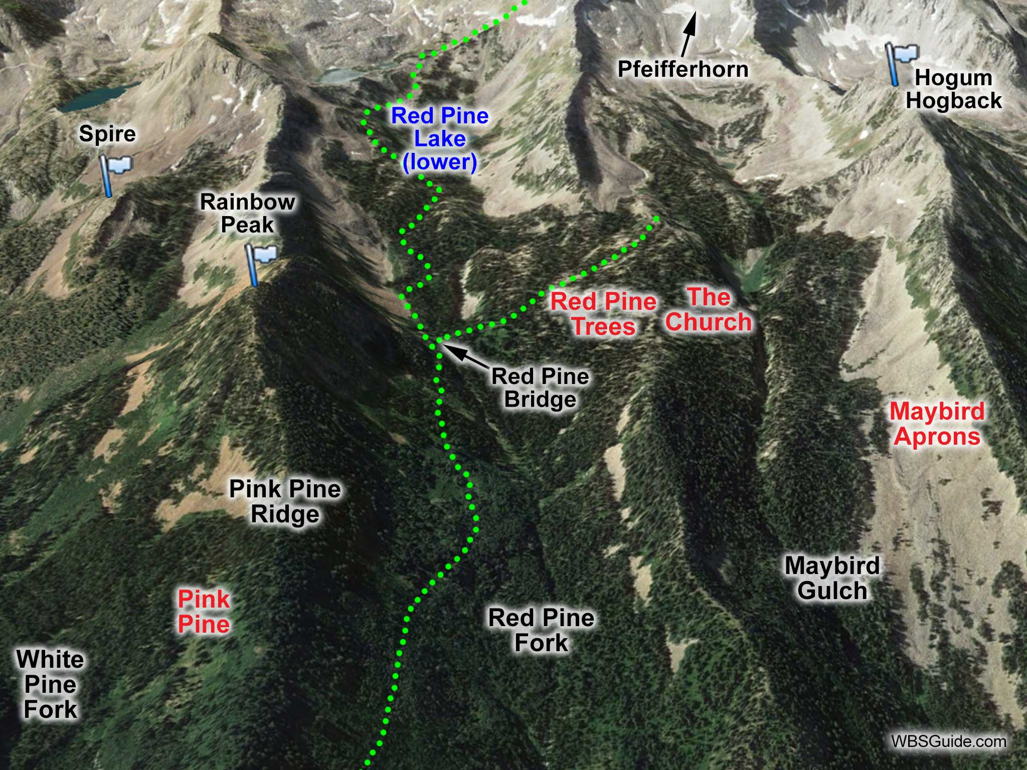
After roughly an hour, you'll see the Red Pine Bridge (also called the Maybird Bridge) which crosses the creek on your right and heads toward Maybird Gulch. That's the route to the Red Pine Trees, The Church, and Maybird Gulch.
If you continue up Red Pine Fork skin track (see the above photo), you'll pass to the left of (or ski across) the lower Red Pine Lake. Further up and above tree line, you'll reach the upper Red Pine Lake. A subtle ridge heads to your right (southwest) from the upper lake to No Name Baldy (not to be confused with No Name Peak). This ridge provides access to Lake Shot (not to be confused with Lake Chute) and continues on to the Pfeifferhorn and its infamous Northwest Couloir.
When you are returning to your car on the Red Pine Fork trail, there are a few sections that are slightly uphill and require side-stepping (or unbinding on a snowboard).


