


| Scott Hill | |
|---|---|
| Summit Elevation | 10,116' |
| Summit Location | 40.6242° / -111.5675° |
| Online Map | View on wbskiing.com |
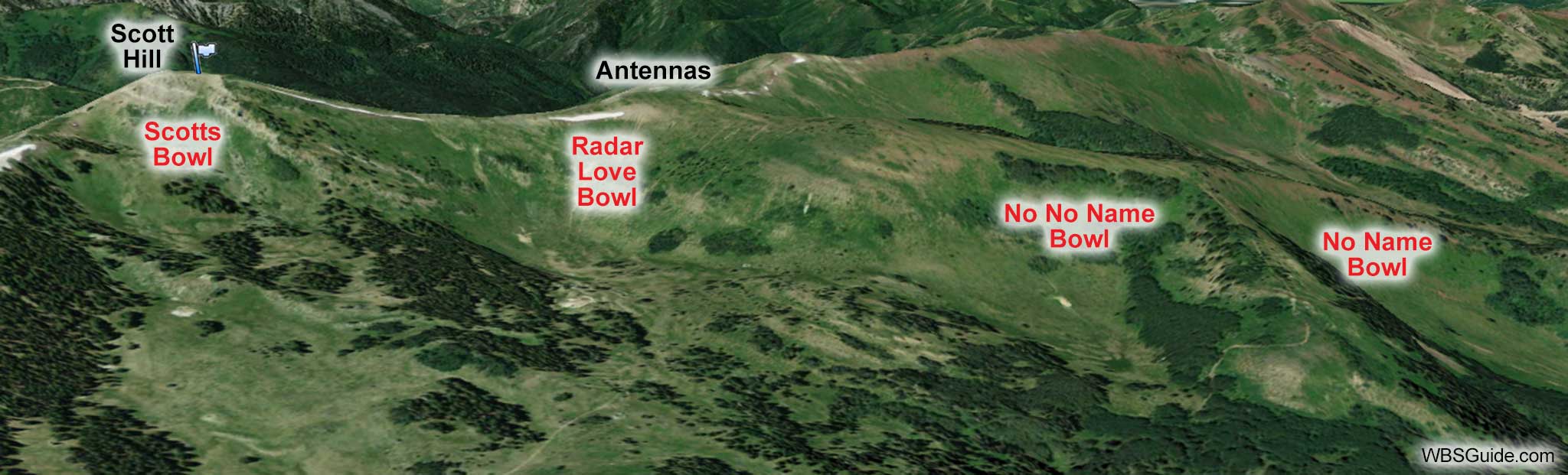
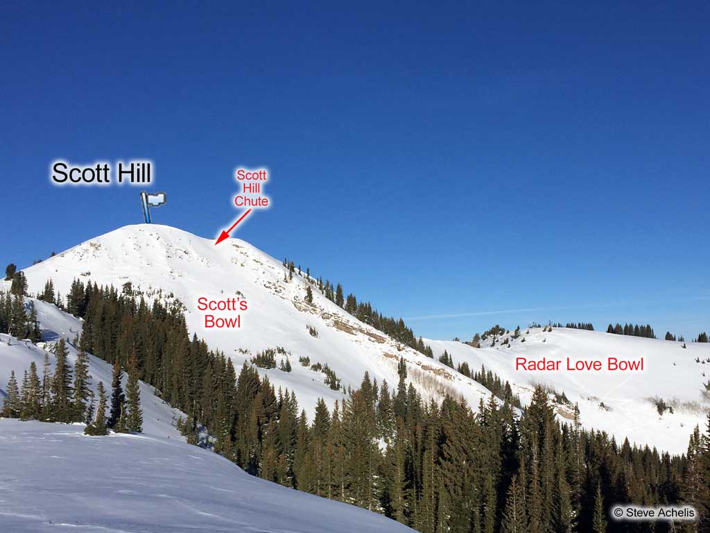
Scott Hill is located on the north side of Big Cottonwood Canyon across from Brighton on Pinecone Ridge. It houses numerous radio antennas. USA Bowl is northwest of Scott Hill. Several popular runs in Summit County are behind Scott Hill, including Scott's Bowl, Scott Hill Chute, Radar Love Bowl, and No No Name Bowl.

| Scott Hill from Guardsman | |
|---|---|
| Trailhead | Guardsman Gate |
| Trailhead Elevation | 8,900' |
| Summit Elevation | 10,116' |
| Total Vertical | 1,200' |
| Skinning Distance | 3.0 miles |
| Online Map | View on wbskiing.com |
To reach Scott Hill, park at the Guardsman winter gate and skin one mile up the road to a right-hand hairpin turn. (Stay near the side of the road to avoid the snowmobilers.) Take the access road which leaves the main road on the left side of this hairpin turn (there is a gate about 200 feet up the access road). Follow that road as it crosses below Scott's Backdoor, goes to Scotts Pass (which overlooks Jupiter Bowl at the Park City ski area), and continues to Pinecone Ridge. (The trail from Scotts Pass to Pinecone Ridge is affectionately called "Puke Hill" by mountain bikers.) Head left (west) along Pinecone Ridge to reach Scott Hill. Depending on all the variables, it will probably take about an hour and a half to the summit.
Returning to the trailhead does require some poling on the flat-ish access and Guardsman roads. This makes this a route little less enjoyable for snowboarders who will probably end up doing some walking.
Optionally, you can reach Scott Hill by taking any route to USA Bowl or the South Monitor and ascend Scott Hill from there.
About the Name
Although many people refer to Scott Hill as Scott's Hill, the name has been Scott Hill all the way back to the 1955 USGS map.


