Beginner terrain
that is good as you develop your backcountry skills and when the avalanche danger is higher. Click for details.
Intermediate
terrain that requires more experience in skinning and skiing. Click for details.
Advanced terrain
that requires strong skiing and skinning skills. Click for details.
Expert terrain that is
challenging and a small mistake can have serious consequences. Click for details.
Extreme terrain
that includes insanely difficult chute skiing and beyond. Click for details.
The difficulty of this terrain
varies widely. Click for details.
This terrain hasn't
been rated. Click for details.
Although this slope was measured, slopes are not homogeneous—this should be considered approximate. Click for details.
This slope angle was not measured. If you get an accurate slope measurement, please send it to me at info@vRigger.com.
The slope angle varies widely. Click for details.
This is the general direction the slope faces. Click for details.
The Utah Avalanche Center says that dangerous avalanches are not expected in this terrain except during extreme or very unusual conditions. Click for details.
The Utah Avalanche Center says that this is generally low-angle terrain although the route may cross under steep avalanche runout zones. Click for details.
The Utah Avalanche Center says that this terrain has significant exposure to numerous commonly-occurring avalanche paths. Click for details.
The Utah Avalanche Center says that this terrain is exposed to significant avalanche hazards often with multiple terrain traps. Click for details.
This terrain can be accessed by resort skiers without skins. Click for details.
This terrain can be accessed by resort skiers without skins. Snowmobiles are allowed. Click for details.
This terrain is commonly skied by helicopter skiers. Click for details.
This terrain is commonly skied by helicopter skiers and by resort skiers without skins. Click for details.
This terrain is commonly skied by helicopter skiers, by resort skiers without skins, and by snowmobilers. Click for details.
This terrain is commonly skied by helicopter skiers. Snowmobiles are allowed. Click for details.
Snowmobiles are allowed in this terrain. Click for details.
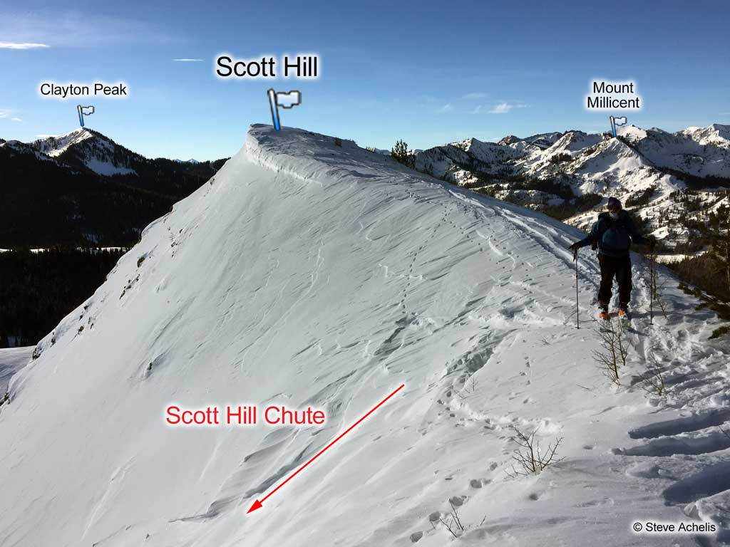
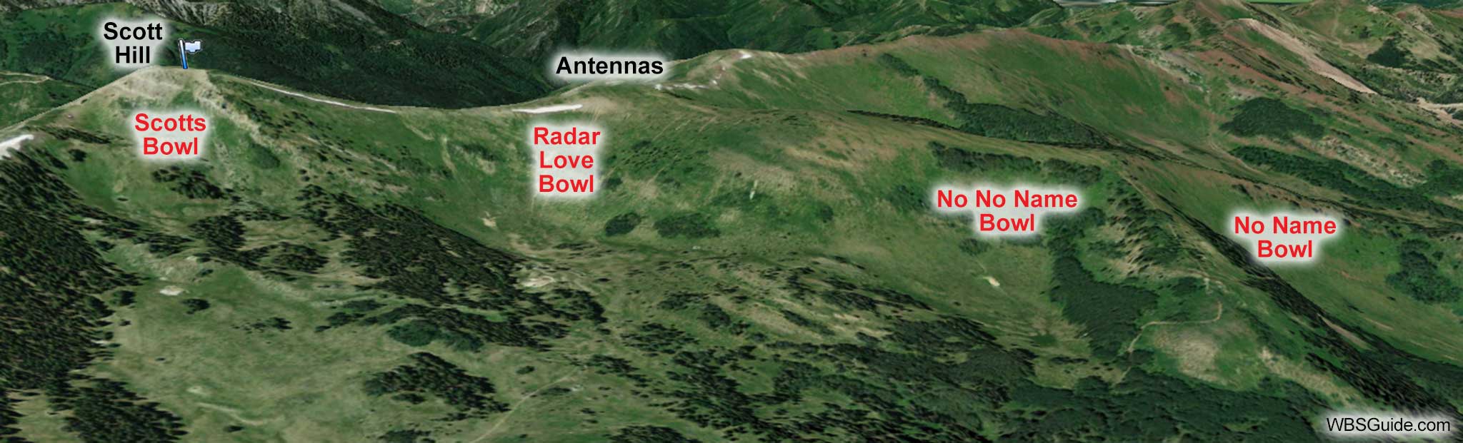
Scott's Bowl is the run on the northeast side of Scott Hill. It is steep and often wind scoured, but in the right conditions it is excellent. You can enter Scott's Bowl mid-slope from the western edge of Pinecone Ridge or you can ski it from the summit of Scott Hill. When coming in from a little north of the summit (Scott Hill Chute) it is a sustained 40° open-chute. From the summit it is steeper, usually corniced, and above small cliffs. When coming in mid-slope it is 34° to 40°.
The name Scott's Bowl applies to the open slopes on the northeast side of Scott Hill. When you get further east (i.e., to the trees along
Pinecone Ridge) the name becomes Fat City Condos.
To create a little confusion,
the Park City ski area has a run named Scott's Bowl which is over the hill from nearby Scott's Backdoor. And to make sure history isn't rewritten, forty years ago what
we now call Scott's Bowl was called Scott's Bluff by backcountry skiers.
Grammaticians who are concerned that Scott's Backdoor and Scott's Bowl have apostrophes whereas Scotts Pass is missing an apostrophe can relax. The USGS doesn't use apostrophes on
names, so I don't when publishing names that appear on USGS maps. However, I do use apostrophes for possessive
names that were created by backcountry users. Thus, I'm consistently inconsistent.