


| Mill B South Fork | |
|---|---|
| Trailhead | Mill B South Fork |
| Location | 40.6157° / -111.7076° |
| Online Map | View on wbskiing.com |
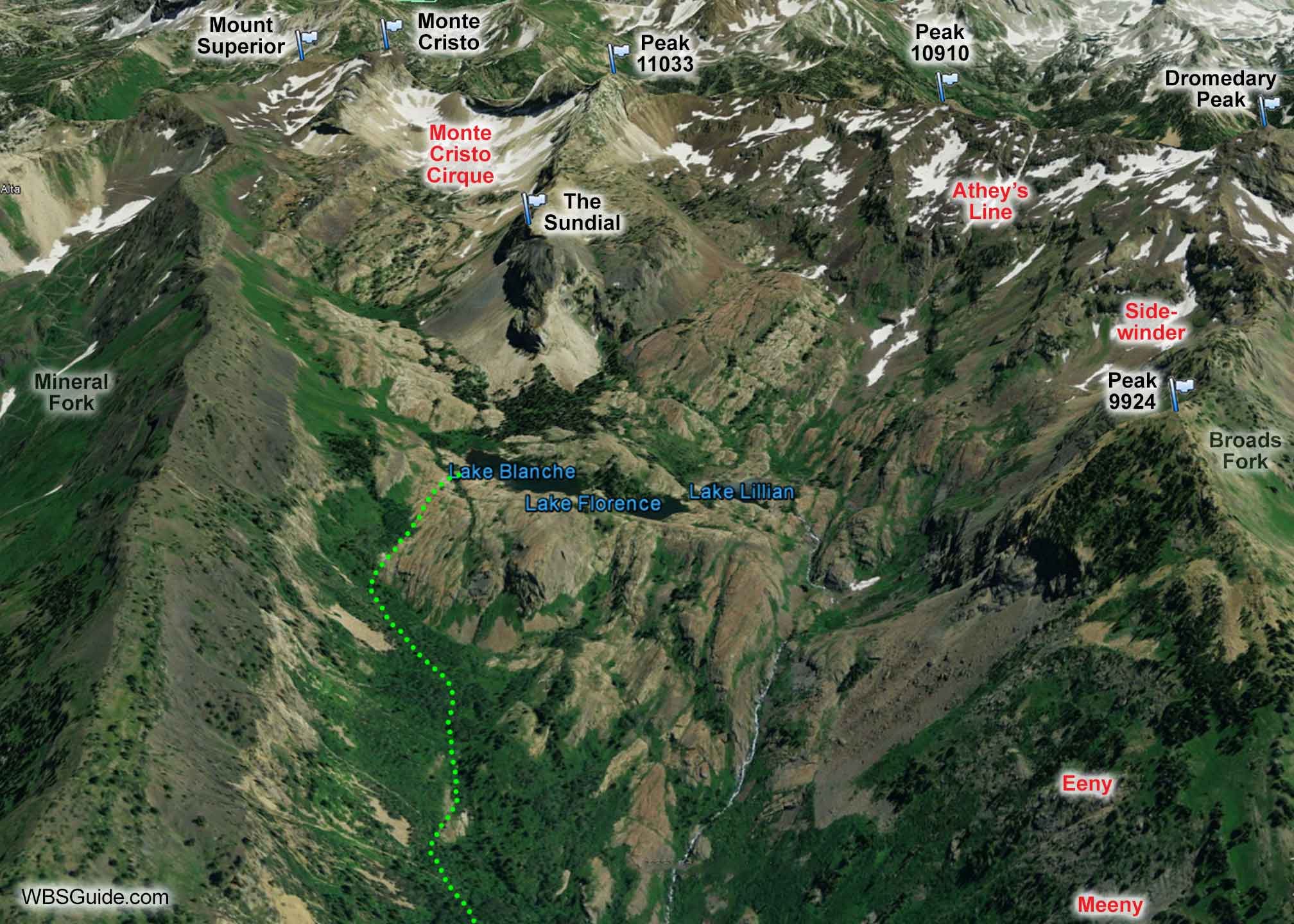
Mill B South Fork starts on the south-side of the S-Turn in Big Cottonwood Canyon. It is down-canyon from Mineral Fork and up-canyon from Broads Fork. Mount Superior, Monte Cristo, and Dromedary Peak are well-know summits at the head of Mill B South Fork. The Sundial is a photogenic peak above a trio of lakes: Lake Blanche, Lake Lillian, and Lake Florence.
Above the lakes, Mill B South Fork is rocky, gnarly, and plagued with challenging lines and avalanche hazards. It's also quiet and rarely visited by skiers. Below the lake is lower angle terrain.
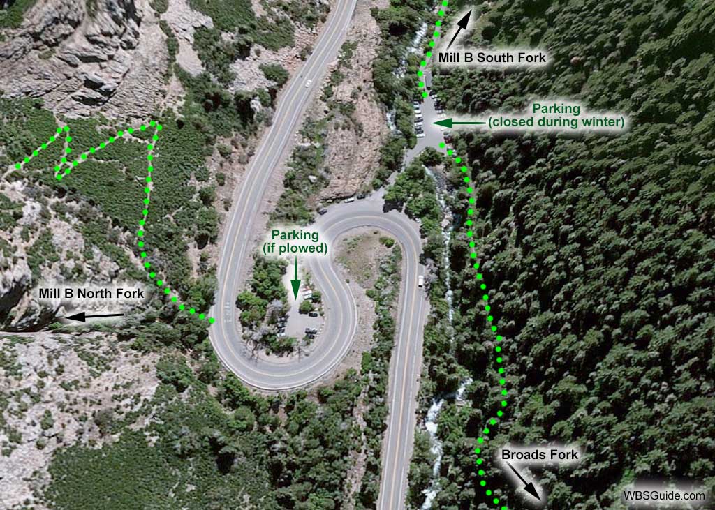
See the description on going to Lake Blanche from the Mill B South trailhead.
About the name
A popular hiking book calls this Lake Blanche Fork which is certainly more descriptive, but this drainage has been called Mill B South Fork since at least the 1955 USGS map.
Mill B is the site of the second of six lumber mills, named Mill A through Mill F, that were built in Big Cottonwood Canyon during the 1800s. The letter designations were based on the order that the mills were built without regard to their location in the canyon. The nearby canyons acquired their names from the mills. A total of 19 lumber mills were eventually built in Big Cottonwood Canyon, although not all of them received letter designations.
Mill B was built by David Brinton, near the mouth of what is now the Mill B South Fork, in 1872.


