Beginner terrain
that is good as you develop your backcountry skills and when the avalanche danger is higher. Click for details.
Intermediate
terrain that requires more experience in skinning and skiing. Click for details.
Advanced terrain
that requires strong skiing and skinning skills. Click for details.
Expert terrain that is
challenging and a small mistake can have serious consequences. Click for details.
Extreme terrain
that includes insanely difficult chute skiing and beyond. Click for details.
The difficulty of this terrain
varies widely. Click for details.
This terrain hasn't
been rated. Click for details.
Although this slope was measured, slopes are not homogeneous—this should be considered approximate. Click for details.
This slope angle was not measured. If you get an accurate slope measurement, please send it to me at info@vRigger.com.
The slope angle varies widely. Click for details.
This is the general direction the slope faces. Click for details.
The Utah Avalanche Center says that dangerous avalanches are not expected in this terrain except during extreme or very unusual conditions. Click for details.
The Utah Avalanche Center says that this is generally low-angle terrain although the route may cross under steep avalanche runout zones. Click for details.
The Utah Avalanche Center says that this terrain has significant exposure to numerous commonly-occurring avalanche paths. Click for details.
The Utah Avalanche Center says that this terrain is exposed to significant avalanche hazards often with multiple terrain traps. Click for details.
This terrain can be accessed by resort skiers without skins. Click for details.
This terrain can be accessed by resort skiers without skins. Snowmobiles are allowed. Click for details.
This terrain is commonly skied by helicopter skiers. Click for details.
This terrain is commonly skied by helicopter skiers and by resort skiers without skins. Click for details.
This terrain is commonly skied by helicopter skiers, by resort skiers without skins, and by snowmobilers. Click for details.
This terrain is commonly skied by helicopter skiers. Snowmobiles are allowed. Click for details.
Snowmobiles are allowed in this terrain. Click for details.
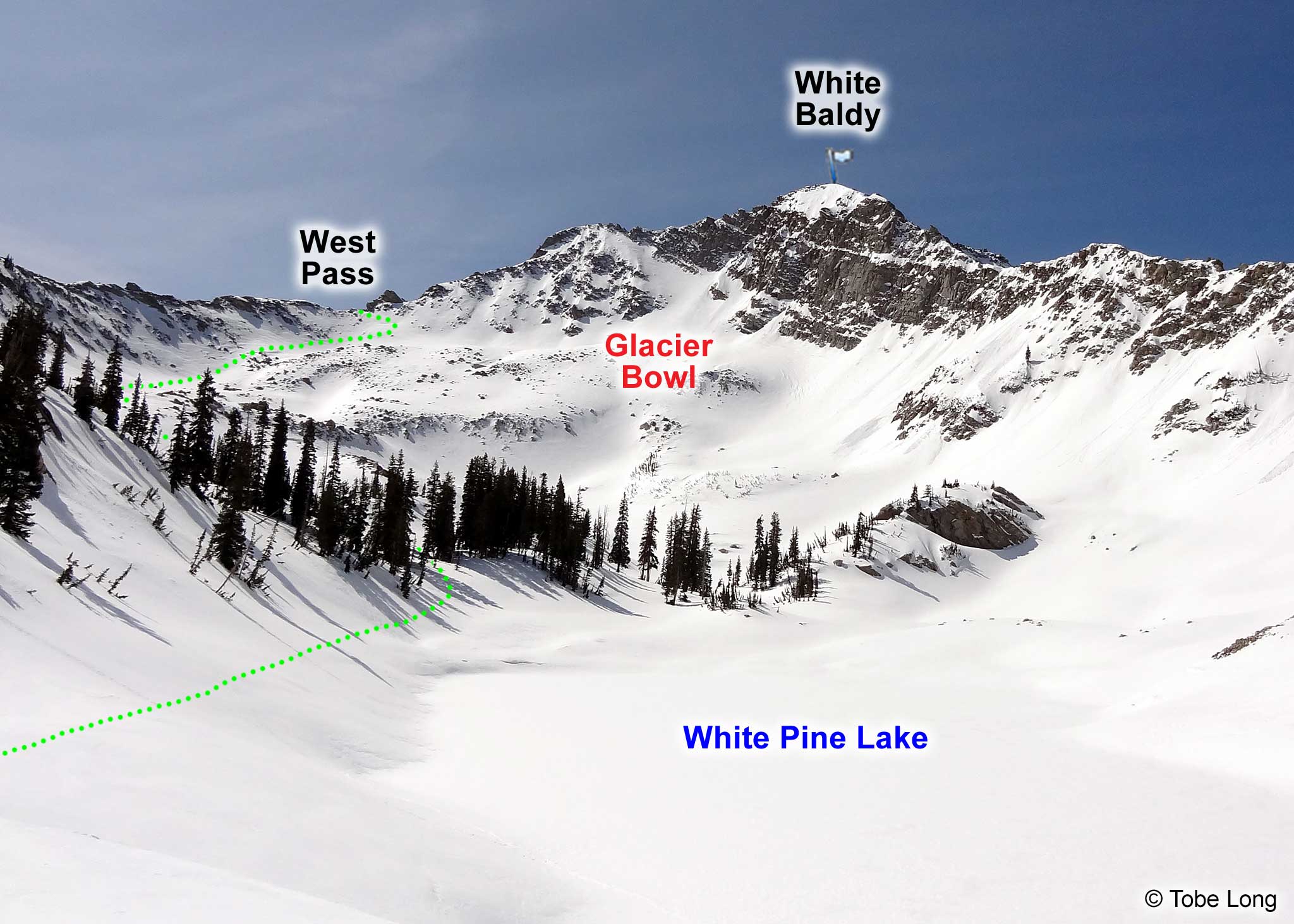
The head of White Pine Fork is split in half by Red Baldy. West Pass is on the west side
of Red Baldy and East Pass is on the east. West Pass is a great destination and offers a spectacular view of White Pine Fork and American Fork. It
will reinforce how fortunate we are to have undeveloped terrain like this in America. It's like the Alps,
but with less development and fewer people. On your way out you can ski Glacier Bowl, or if you're really
ambitious, ascend Red Baldy and ski it.
Getting to West Pass
Follow the directions into White Pine Fork from the White Pine trailhead.
Continue up the main drainage, bearing slightly right (west) as you near Red Baldy (or you'll end up at
the East Pass). Some people ascend near the base of Red Baldy while others skin up by White Pine Lake.
Your choice.
Continue to work your way up the slope to the West Pass. Depending on the weather and time of year, the
last few hundred feet can be a bit icy. It takes three or four hours to reach West Pass from the trailhead.