Beginner terrain
that is good as you develop your backcountry skills and when the avalanche danger is higher. Click for details.
Intermediate
terrain that requires more experience in skinning and skiing. Click for details.
Advanced terrain
that requires strong skiing and skinning skills. Click for details.
Expert terrain that is
challenging and a small mistake can have serious consequences. Click for details.
Extreme terrain
that includes insanely difficult chute skiing and beyond. Click for details.
The difficulty of this terrain
varies widely. Click for details.
This terrain hasn't
been rated. Click for details.
Although this slope was measured, slopes are not homogeneous—this should be considered approximate. Click for details.
This slope angle was not measured. If you get an accurate slope measurement, please send it to me at info@vRigger.com.
The slope angle varies widely. Click for details.
This is the general direction the slope faces. Click for details.
The Utah Avalanche Center says that dangerous avalanches are not expected in this terrain except during extreme or very unusual conditions. Click for details.
The Utah Avalanche Center says that this is generally low-angle terrain although the route may cross under steep avalanche runout zones. Click for details.
The Utah Avalanche Center says that this terrain has significant exposure to numerous commonly-occurring avalanche paths. Click for details.
The Utah Avalanche Center says that this terrain is exposed to significant avalanche hazards often with multiple terrain traps. Click for details.
This terrain can be accessed by resort skiers without skins. Click for details.
This terrain can be accessed by resort skiers without skins. Snowmobiles are allowed. Click for details.
This terrain is commonly skied by helicopter skiers. Click for details.
This terrain is commonly skied by helicopter skiers and by resort skiers without skins. Click for details.
This terrain is commonly skied by helicopter skiers, by resort skiers without skins, and by snowmobilers. Click for details.
This terrain is commonly skied by helicopter skiers. Snowmobiles are allowed. Click for details.
Snowmobiles are allowed in this terrain. Click for details.
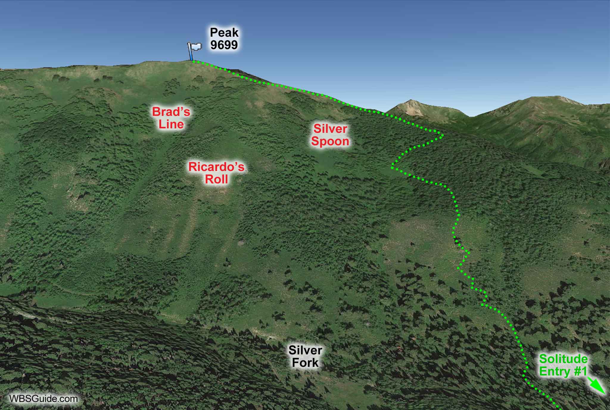
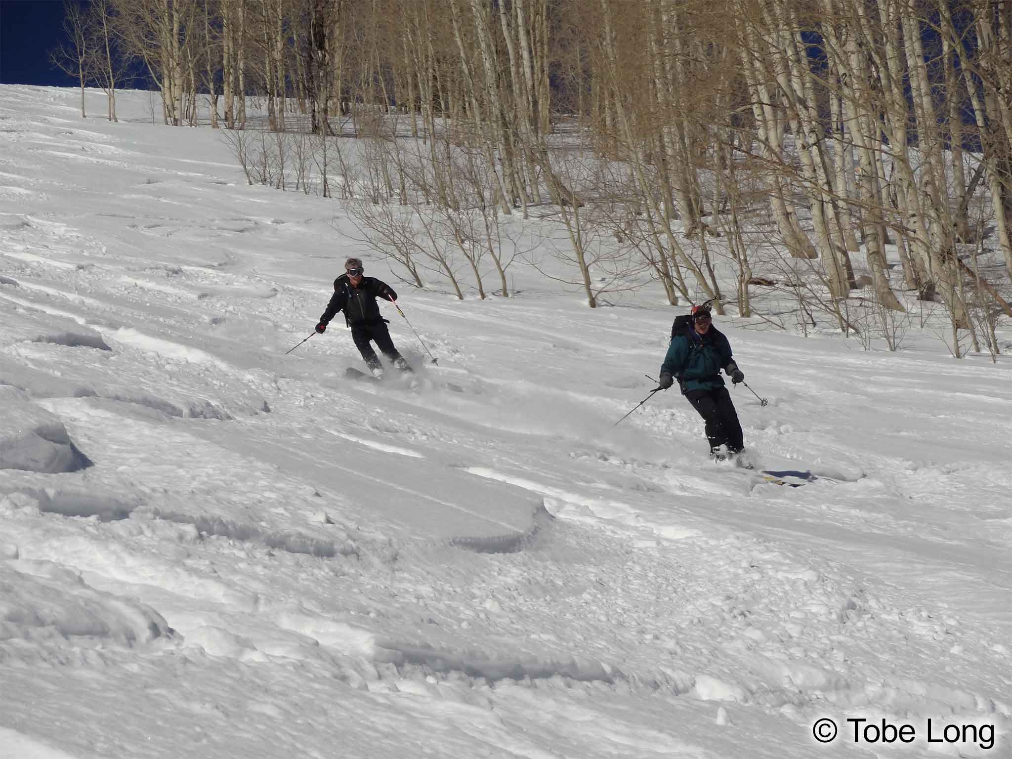
Brad's Line is an easy-to-ski, close to the road, popular run that is fall-line from Peak 9699 in Silver Fork. You can ski Brad's Line, car-to-car,
in under three hours.
Brad's Line is on the skier's left edge of the Meadow Chutes.
Follow the directions into Silver Fork from Big Cottonwood Canyon. About 30 minutes after
leaving your car (and about 0.4 mile past the last cabin), you'll come to the outhouse mention in the Silver
Fork directions. A skin track usually leaves somewhere near here (often just before the outhouse) and
climbs observer's right of Silver Spoon to Peak 9699. Brad's Line starts at Peak 9699.
About the name
Originally called Lucky Lynn's by the Powderbird guides, Brad's Line is a more popular name with backcountry
riders.
Don't confuse Brad's Line with Brad's Run which is on the 10420 ridgeline.