Beginner terrain
that is good as you develop your backcountry skills and when the avalanche danger is higher. Click for details.
Intermediate
terrain that requires more experience in skinning and skiing. Click for details.
Advanced terrain
that requires strong skiing and skinning skills. Click for details.
Expert terrain that is
challenging and a small mistake can have serious consequences. Click for details.
Extreme terrain
that includes insanely difficult chute skiing and beyond. Click for details.
The difficulty of this terrain
varies widely. Click for details.
This terrain hasn't
been rated. Click for details.
Although this slope was measured, slopes are not homogeneous—this should be considered approximate. Click for details.
This slope angle was not measured. If you get an accurate slope measurement, please send it to me at info@vRigger.com.
The slope angle varies widely. Click for details.
This is the general direction the slope faces. Click for details.
The Utah Avalanche Center says that dangerous avalanches are not expected in this terrain except during extreme or very unusual conditions. Click for details.
The Utah Avalanche Center says that this is generally low-angle terrain although the route may cross under steep avalanche runout zones. Click for details.
The Utah Avalanche Center says that this terrain has significant exposure to numerous commonly-occurring avalanche paths. Click for details.
The Utah Avalanche Center says that this terrain is exposed to significant avalanche hazards often with multiple terrain traps. Click for details.
This terrain can be accessed by resort skiers without skins. Click for details.
This terrain can be accessed by resort skiers without skins. Snowmobiles are allowed. Click for details.
This terrain is commonly skied by helicopter skiers. Click for details.
This terrain is commonly skied by helicopter skiers and by resort skiers without skins. Click for details.
This terrain is commonly skied by helicopter skiers, by resort skiers without skins, and by snowmobilers. Click for details.
This terrain is commonly skied by helicopter skiers. Snowmobiles are allowed. Click for details.
Snowmobiles are allowed in this terrain. Click for details.
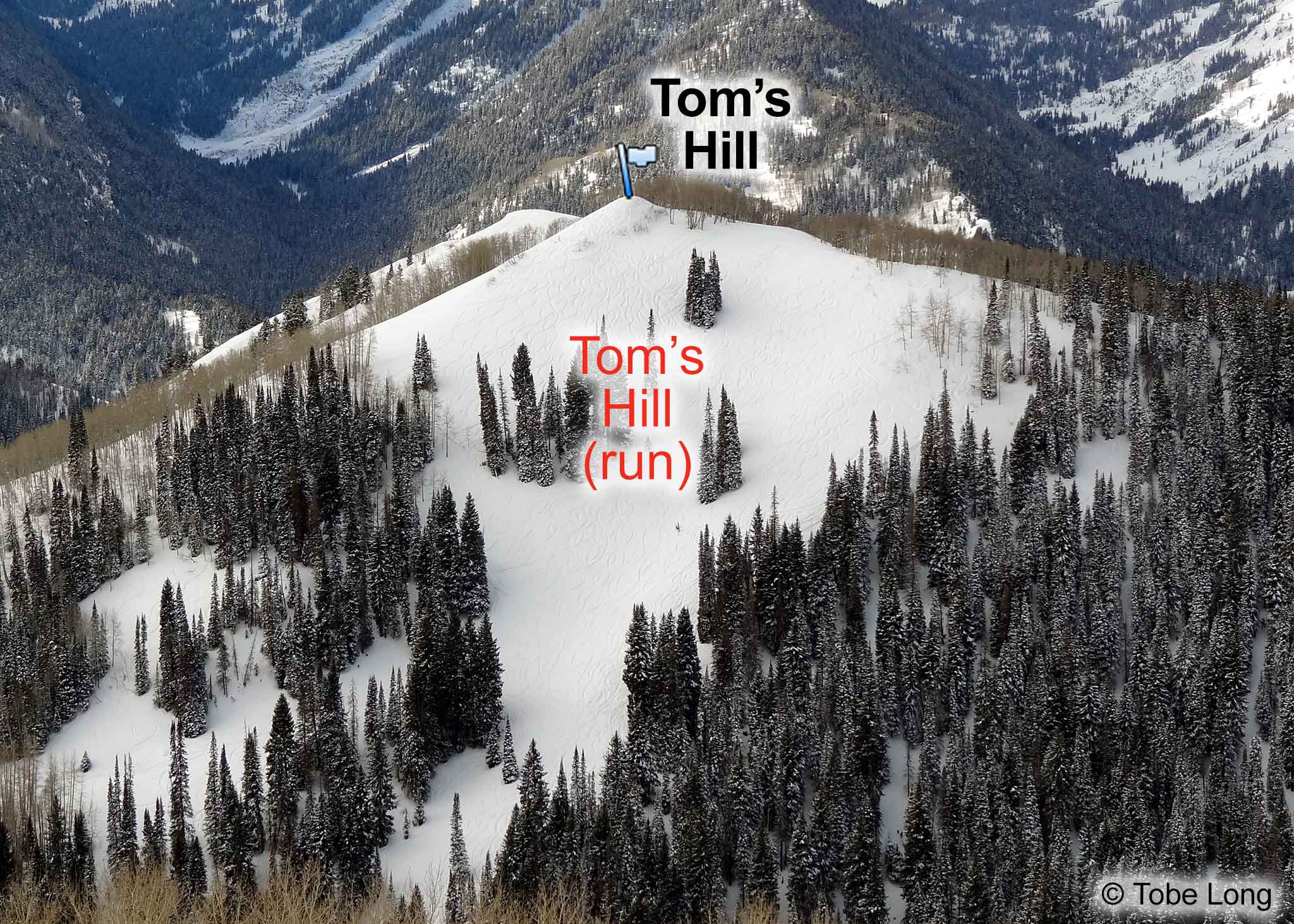
Tom's Hill run is on the northeast side of Tom's Hill. It provides great skiing, albeit
short, through an open glade nestled in fir trees. Its relative proximity to the road, gentle slope, and
good snow make it a popular destination. It's easy to sneak in a run on Tom's Hill after skiing the East
Face of Reynolds.
Follow the directions to Mill D North Fork from the Spruces trailhead. When the trail splits between Dog Lake and Lake Desolation, take the left-hand branch toward Dog Lake. Approximately five minutes after the split, and ~10 minutes before reaching Dog Lake, the main track
makes a gentle right-hand turn. The normally-present and well-smashed trail departs from the main track on the left side of this turn, crosses a tiny gully, and heads up to the summit of Tom's Hill.
About the name
Although many people suspect that Tom's Hill is named after the Utah Avalanche Center's Tom Kimbrough, when asked, Tom told me, "I was a late arrival to the Wasatch (winter of '82-83) and that name was already in place. I have no idea who that Tom was."