Beginner terrain
that is good as you develop your backcountry skills and when the avalanche danger is higher. Click for details.
Intermediate
terrain that requires more experience in skinning and skiing. Click for details.
Advanced terrain
that requires strong skiing and skinning skills. Click for details.
Expert terrain that is
challenging and a small mistake can have serious consequences. Click for details.
Extreme terrain
that includes insanely difficult chute skiing and beyond. Click for details.
The difficulty of this terrain
varies widely. Click for details.
This terrain hasn't
been rated. Click for details.
Although this slope was measured, slopes are not homogeneous—this should be considered approximate. Click for details.
This slope angle was not measured. If you get an accurate slope measurement, please send it to me at info@vRigger.com.
The slope angle varies widely. Click for details.
This is the general direction the slope faces. Click for details.
The Utah Avalanche Center says that dangerous avalanches are not expected in this terrain except during extreme or very unusual conditions. Click for details.
The Utah Avalanche Center says that this is generally low-angle terrain although the route may cross under steep avalanche runout zones. Click for details.
The Utah Avalanche Center says that this terrain has significant exposure to numerous commonly-occurring avalanche paths. Click for details.
The Utah Avalanche Center says that this terrain is exposed to significant avalanche hazards often with multiple terrain traps. Click for details.
This terrain can be accessed by resort skiers without skins. Click for details.
This terrain can be accessed by resort skiers without skins. Snowmobiles are allowed. Click for details.
This terrain is commonly skied by helicopter skiers. Click for details.
This terrain is commonly skied by helicopter skiers and by resort skiers without skins. Click for details.
This terrain is commonly skied by helicopter skiers, by resort skiers without skins, and by snowmobilers. Click for details.
This terrain is commonly skied by helicopter skiers. Snowmobiles are allowed. Click for details.
Snowmobiles are allowed in this terrain. Click for details.
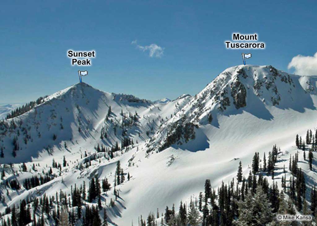
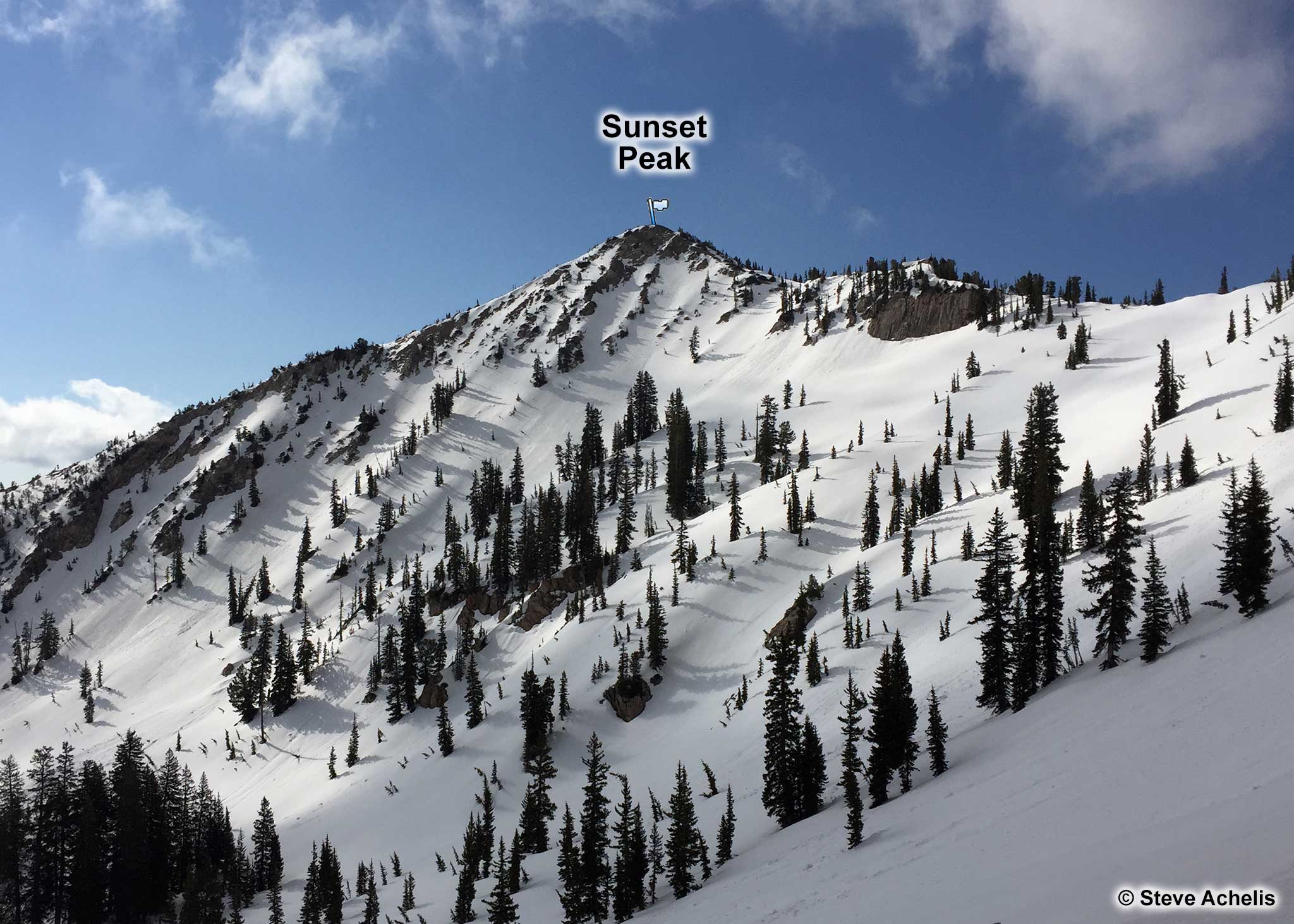
The summit of Sunset Peak is the border between Salt Lake County, Wasatch County, and Utah County.
If you place your boot precisely, it will be in all three counties at the same time. Sunset Peak is located next to Pioneer Peak and overlooks Lake Catherine.
Sunset Peak's north facing slope contains a half-dozen, scalloped chutes that average approximately 40°. They provide excellent chute skiing with significant avalanche hazard—Skiers Doyle Murray and Tim Wiggins died in an avalanche near here on November 13, 1985.
You can get to Sunset Peak either by riding Alta's Supreme chairlift, following the ridgeline over Point Supreme to Rocky
Point, and then continuing on to Sunset Peak. Or you can park at the Grizzly Gulch trailhead, follow the directions to Catherine Pass, go over Rocky Point, and continue up the ridge to Sunset Peak.