


| Todd's Bowl | |
|---|---|
| Drainage | Lambs Canyon |
| Terrain | Bowl and Trees |
| Typical Vertical | 900' |
| Location | 40.6952° / -111.6032° |
| Online Map | View on wbskiing.com |
Todd's Bowl is on the north side of Murdock Peak. The run begins about 150 feet east of the Murdock Peak summit.
The upper portion of the run, above the trees (as shown in the following image), is a consistent 40°. In the trees, it averages around 45°.
Optionally, you can ski the ridgeline on the skier's left side of the bowl which averages a mellower 25°. However, if you diverge from the ridge into the bowl, the slope angle immediately increases.
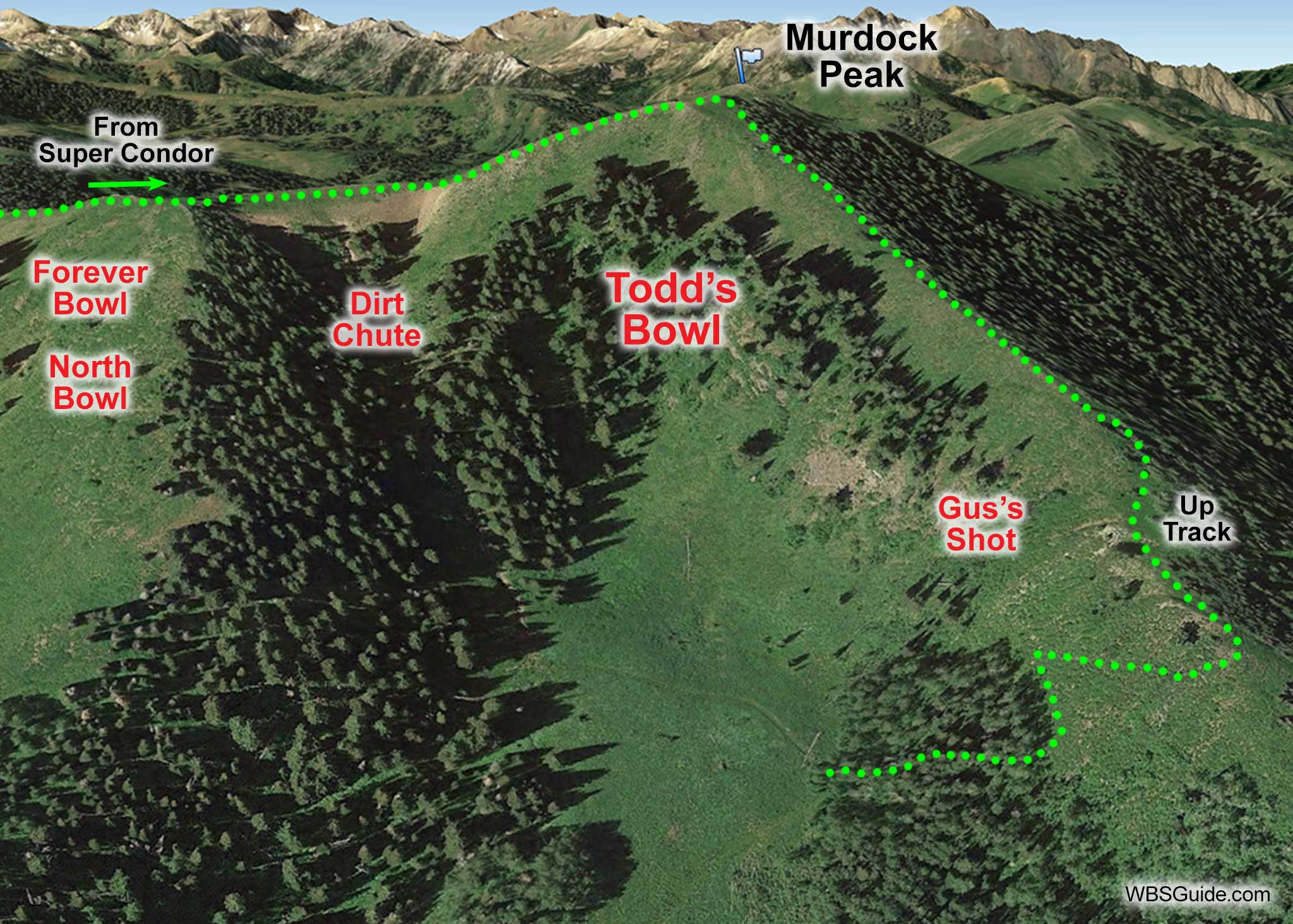

Gus Mora died in an avalanche on the skier's left side of Todd's Bowl in 1982 (read the accident report). The slope in this area is a little over 40°. This location (presumably near where he died) is sometimes referred to as Gus's Shot.
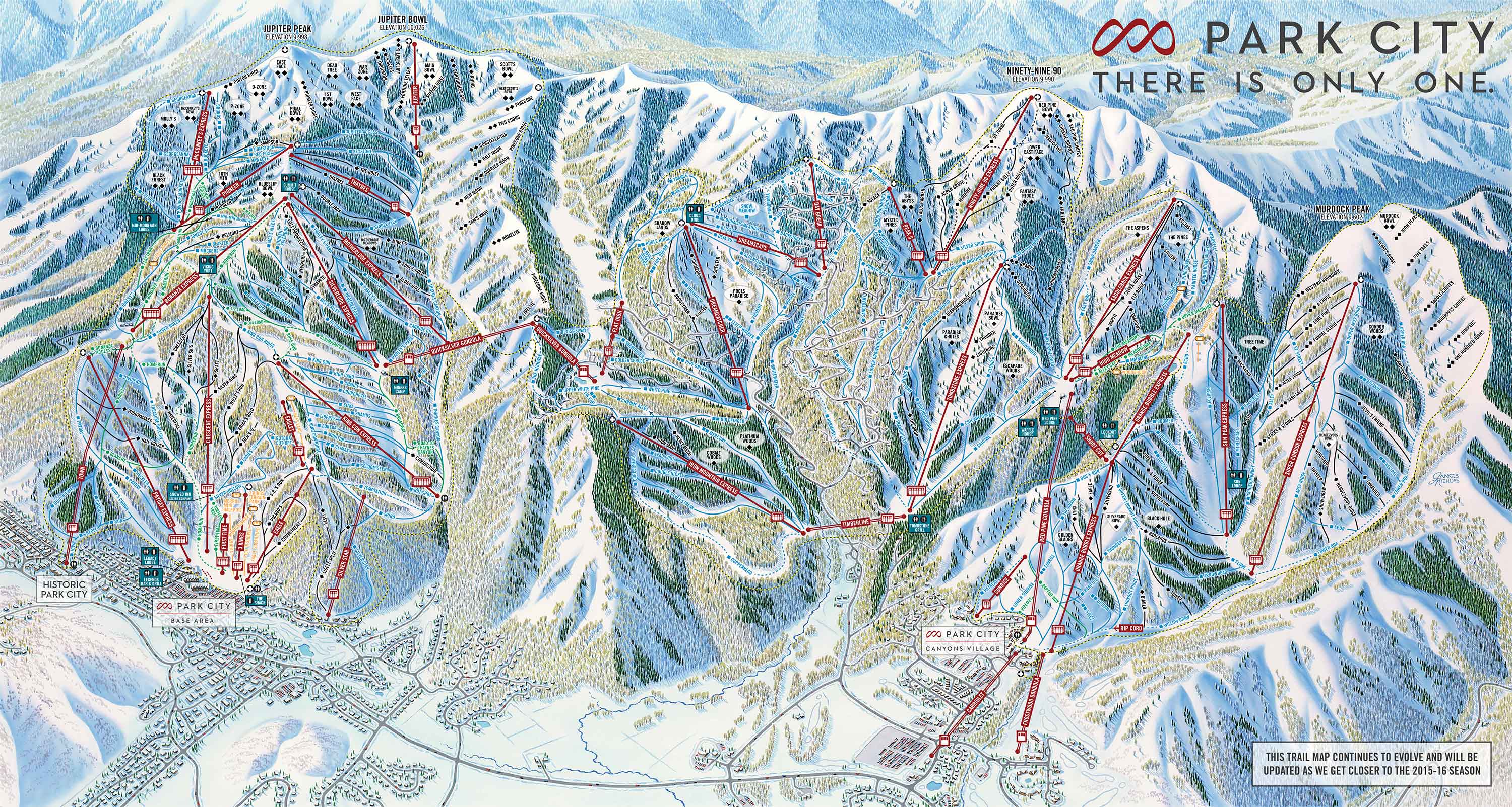
NOTICE: I have been told that it is illegal to access the Murdock Peak area from the Super Condor chairlift as explained here (i.e., ducking the rope above the boot pack is not permitted). Apparently, the only legal access is from the Peak 5 chairlift which is too far away as to be impractical.
As with Forever (North) Bowl and Dirt Chute, Todd's Bowl is so close to the Park City resort that it is almost always accessed from the lifts. To do so, start at Canyons Village, ride the Orange Bubble chairlift, and then ride the Super Condor chairlift.
From the top of the Super Condor chairlift, ski about 1,000 feet straight ahead to the backcountry gate that provides access to what Park City calls Murdock Bowl (the location of Murdock Peak on the Park City trail map is a bit creative).
Boot up the trail for about 10 minutes until you reach a flattish area (there is a ski patrol toboggan here), put on your skins, and skin the gentle ridge up-and-to-your-right toward Murdock Peak. Unless it is dumping, you will have a good view of Murdock Peak which is about a third of a mile from the flattish area and is crowned with a small building and a couple of antennas. Todd's Bowl is the obvious run on your right that starts about 150 feet before Murdock Peak.


