Beginner terrain
that is good as you develop your backcountry skills and when the avalanche danger is higher. Click for details.
Intermediate
terrain that requires more experience in skinning and skiing. Click for details.
Advanced terrain
that requires strong skiing and skinning skills. Click for details.
Expert terrain that is
challenging and a small mistake can have serious consequences. Click for details.
Extreme terrain
that includes insanely difficult chute skiing and beyond. Click for details.
The difficulty of this terrain
varies widely. Click for details.
This terrain hasn't
been rated. Click for details.
Although this slope was measured, slopes are not homogeneous—this should be considered approximate. Click for details.
This slope angle was not measured. If you get an accurate slope measurement, please send it to me at info@vRigger.com.
The slope angle varies widely. Click for details.
This is the general direction the slope faces. Click for details.
The Utah Avalanche Center says that dangerous avalanches are not expected in this terrain except during extreme or very unusual conditions. Click for details.
The Utah Avalanche Center says that this is generally low-angle terrain although the route may cross under steep avalanche runout zones. Click for details.
The Utah Avalanche Center says that this terrain has significant exposure to numerous commonly-occurring avalanche paths. Click for details.
The Utah Avalanche Center says that this terrain is exposed to significant avalanche hazards often with multiple terrain traps. Click for details.
This terrain can be accessed by resort skiers without skins. Click for details.
This terrain can be accessed by resort skiers without skins. Snowmobiles are allowed. Click for details.
This terrain is commonly skied by helicopter skiers. Click for details.
This terrain is commonly skied by helicopter skiers and by resort skiers without skins. Click for details.
This terrain is commonly skied by helicopter skiers, by resort skiers without skins, and by snowmobilers. Click for details.
This terrain is commonly skied by helicopter skiers. Snowmobiles are allowed. Click for details.
Snowmobiles are allowed in this terrain. Click for details.
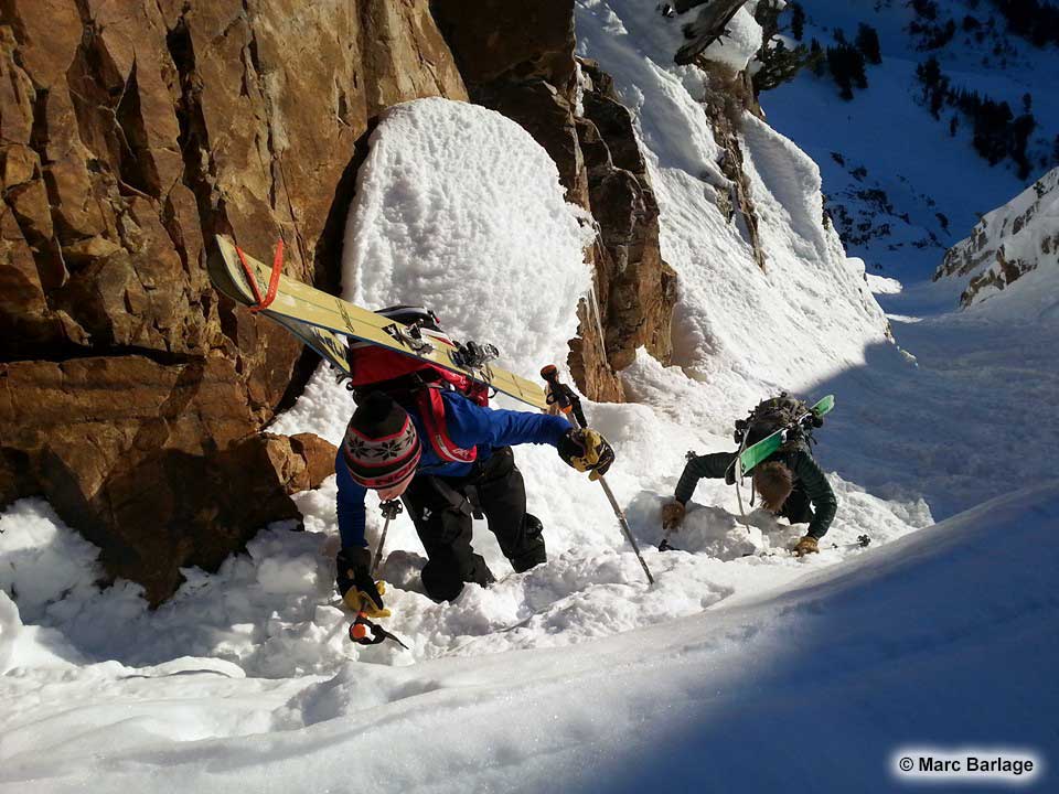
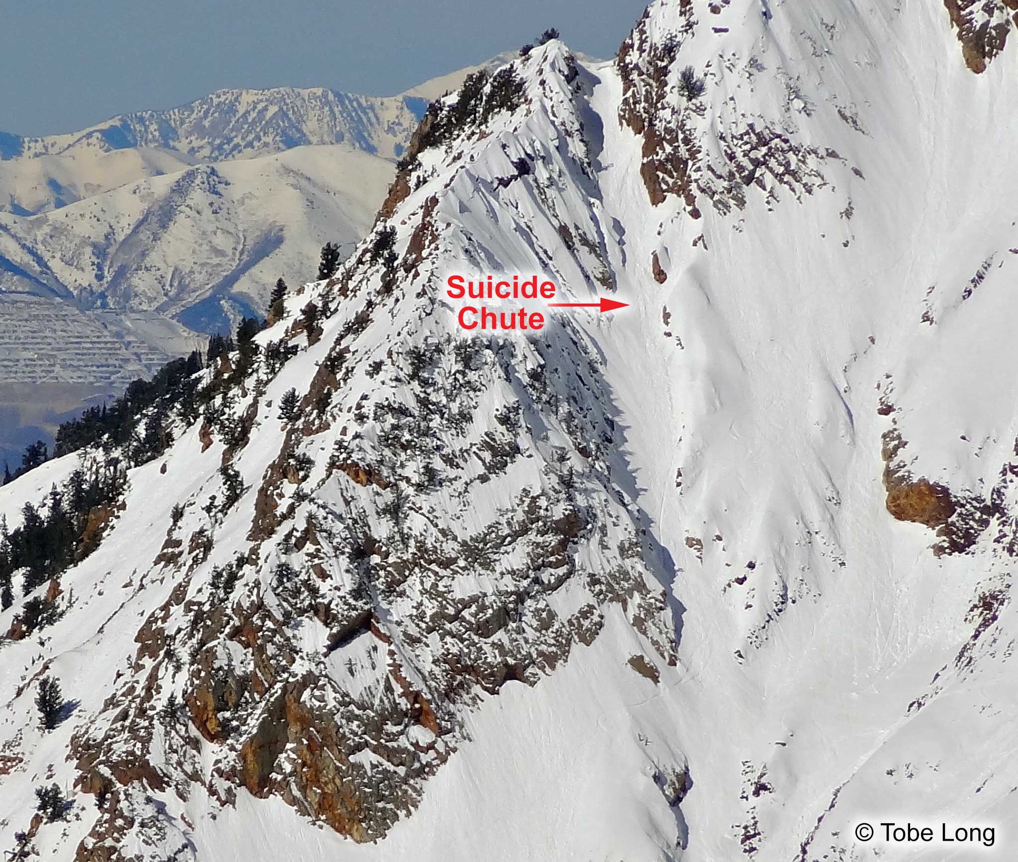
Suicide Chute is an east-facing couloir on Mount Superior. When you are driving down from Alta, Suicide looks
nearly-vertical. It's a classic Wasatch line that deserves to be skied.
Suicide Chute is most commonly skied in the spring when the avalanche hazard is low. It often requires
an early start so you will be at the top when the snow softens. When the snow is hard, crampons and an ice
axe (and the skills to use them) are helpful.
This video is a little sensational, but it
has outstanding footage of Suicide Chute.
Getting to Suicide Chute
Park on the north (left) side of the Little Cottonwood Canyon road approximately 0.3 of a mile past Snowbird Entry #4
(aka the "Chickadee entrance"). Boot or skin to the base of the chute. Boot up the chute.
About the Name
Suicide Chute has two other names: Country Lane and Shane's Chute. Although now called Suicide Chute
almost exclusively, the original name, and the name we all should be using, is Shane's Chute.
Jim Shane was a weekend ski patroller at Alta back in the late-1940s. Jim and his wife Elfriede envisioned
a lodge at Alta, lobbied congress for permission, and built the Goldminer's Daughter Lodge which opened
to the public in 1962. Jim was a badass skier who skied Suicide Shane's Chute wearing leather boots
and wooden skis.
Jim Conway began calling Suicide Couloir "Country Lane" when he skied it with Doug Coombs in 1985. He said he did this "half in jest," because the run was so "simple mellow." Jim told me he was surprised the name had survived and that he agreed it should be called Shane's Chute. (The name Country Lane "survived," because Andrew McLean mentioned it in his book, The Chuting Gallery.)