Beginner terrain
that is good as you develop your backcountry skills and when the avalanche danger is higher. Click for details.
Intermediate
terrain that requires more experience in skinning and skiing. Click for details.
Advanced terrain
that requires strong skiing and skinning skills. Click for details.
Expert terrain that is
challenging and a small mistake can have serious consequences. Click for details.
Extreme terrain
that includes insanely difficult chute skiing and beyond. Click for details.
The difficulty of this terrain
varies widely. Click for details.
This terrain hasn't
been rated. Click for details.
Although this slope was measured, slopes are not homogeneous—this should be considered approximate. Click for details.
This slope angle was not measured. If you get an accurate slope measurement, please send it to me at info@vRigger.com.
The slope angle varies widely. Click for details.
This is the general direction the slope faces. Click for details.
The Utah Avalanche Center says that dangerous avalanches are not expected in this terrain except during extreme or very unusual conditions. Click for details.
The Utah Avalanche Center says that this is generally low-angle terrain although the route may cross under steep avalanche runout zones. Click for details.
The Utah Avalanche Center says that this terrain has significant exposure to numerous commonly-occurring avalanche paths. Click for details.
The Utah Avalanche Center says that this terrain is exposed to significant avalanche hazards often with multiple terrain traps. Click for details.
This terrain can be accessed by resort skiers without skins. Click for details.
This terrain can be accessed by resort skiers without skins. Snowmobiles are allowed. Click for details.
This terrain is commonly skied by helicopter skiers. Click for details.
This terrain is commonly skied by helicopter skiers and by resort skiers without skins. Click for details.
This terrain is commonly skied by helicopter skiers, by resort skiers without skins, and by snowmobilers. Click for details.
This terrain is commonly skied by helicopter skiers. Snowmobiles are allowed. Click for details.
Snowmobiles are allowed in this terrain. Click for details.
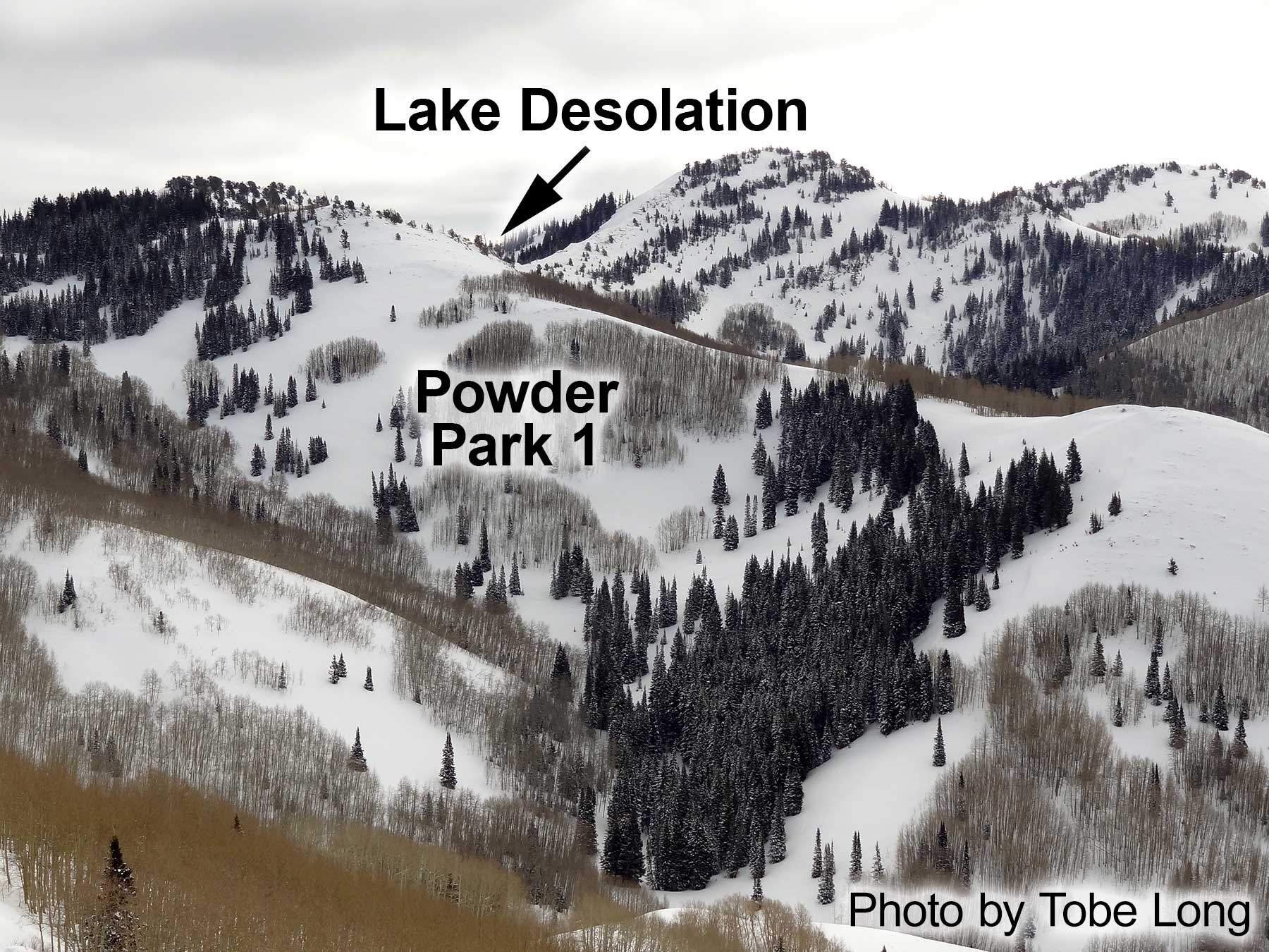
The entire bowl-like area in upper Mill D North Fork is the original Powder Park. As with other open, low-angle terrain gained the same name, they were numbered. Nowadays "Powder Park 1" primarily refers to the north-facing slope in upper Mill D Fork shown in this photo. This slope contains a smattering of evergreen trees and although it is mostly low angle, it has a few steeper patches that can avalanche.
The more open south-facing slopes, which share Sheep Shit Ridge with Mill Creek Canyon, contain small groves of aspen trees and are lower angle. There is also gentle west-facing terrain in the eastern end of Powder Park 1.
Powder Park 1 requires a relatively long trek for relatively short runs, but the length of the approach
does reduce the number of visitors.
Follow the instructions toward Lake Desolation via Mill D North Fork. About a mile before Lake Desolation, the skin track passes
to the left of a large meadow (it's several football fields
long and looks like a frozen lake when it is covered with snow). After skinning alongside the meadow for approximately 500 feet, the skin track to Powder Park 1 branches
up a small gully to the left. The main trail continues on to Lake Desolation.
About the name
See the comments on the Powder Park 3 page for additional information about the naming of the Powder Parks.