


| Flagstaff Mountain from Central Alta | |
|---|---|
| Summit Elevation | 10,630' |
| Summit Location | 40.6008° / -111.6461° |
| Trailhead | Central Alta Trailhead |
| Ascent Vertical | 1,960' |
| Skinning Distance | 1.1 miles |
| Online Map | View on wbskiing.com |
| False Flagstaff from Central Alta | |
|---|---|
| Summit Elevation | 10,300' |
| Summit Location | 40.5989° / -111.6421° |
| Trailhead | Central Alta Trailhead |
| Ascent Vertical | 1,630' |
| Skinning Distance | 0.8 miles |
| Online Map | View on wbskiing.com |
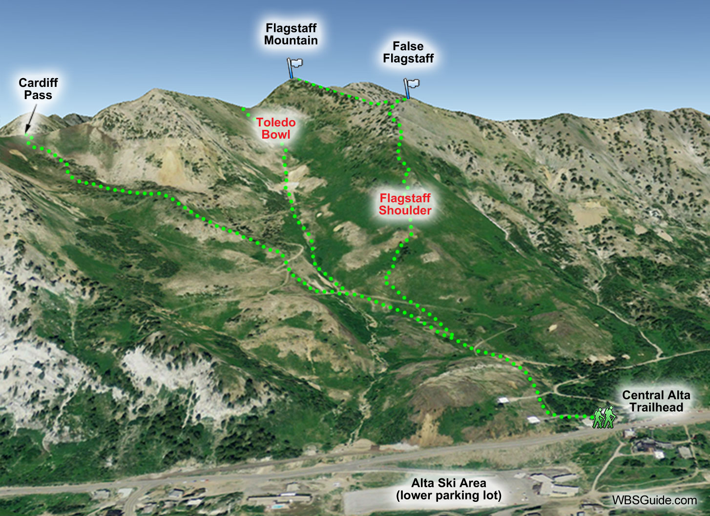
Flagstaff Mountain is the peak between Cardiff Fork and Days Fork. The peak that we see, and ski, from Little Cottonwood Canyon (and which most people call Flagstaff Mountain), is actually a false peak that is 0.25 miles southeast of, and 300 feet lower than, the actual summit.
The south-facing runs off of (False) Flagstaff Mountain provide a quick tour. You can easily go car-to-car in under two hours. These slopes can be soggy on warm days, but given the right conditions they can provide excellent winter powder and springtime corn.
From the top of Flagstaff Mountain you can ski Toledo Bowl, Waggy Chute, and Upper Days. Two Dogs is directly on the other side of the false peak. Or you can keep the session short by skiing Flagstaff Face. You'll may want to avoid getting sucked into the gullies on Flagstaff's south-facing slopes because they can limit your options (and increase the avalanche risk), although they also provide a halfpipe-like feature.
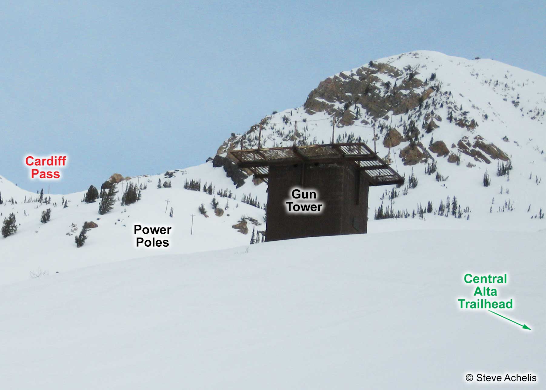
The ascent starts as if you were going to Cardiff Pass from the Central Alta trailhead: Park at the Central Alta trailhead, head west from the beacon checking station, pass the gun tower, and follow the power lines. However, when you reach the south-facing Flagstaff Shoulder, depart from the Cardiff Pass route and follow the skin track as it switchbacks up the steepish shoulder. The final several hundred feet get a little steeper, but it's worth persevering. There's often a snowboarder's boot path directly up the shoulder. From the top of the false peak, you can continue northwest to the "real" Flagstaff Mountain.


